-
Falls Trail
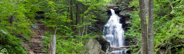
Falls Trail is 3.2 miles of mountainous terrain within Ricketts Glen State Park’s verdant wilderness. 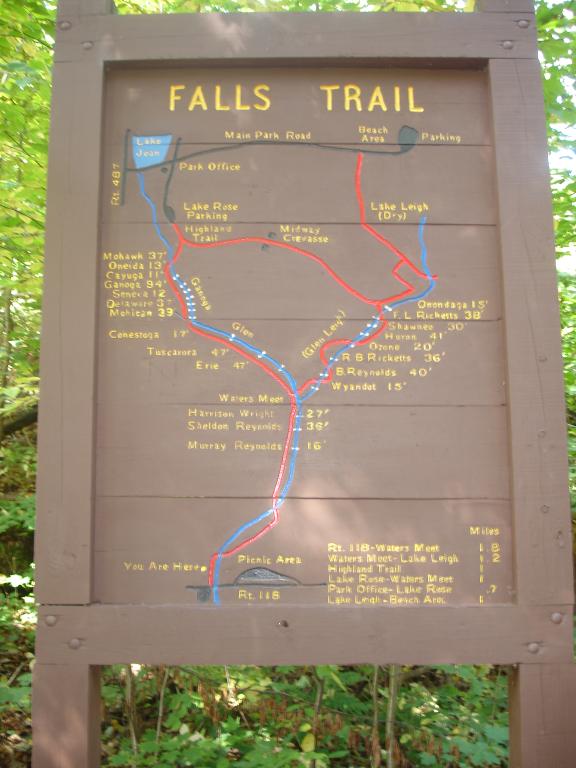 Along the climb, catch sight of 18 of the 22 cascading waterfalls, including the breathtaking 94-foot Ganoga Falls. Or, if you are feeling up for it, hike the full 7.2 mile loop that includes both the upper and lower sections. Hikers on this trail should be physically fit, experienced, and wearing appropriate clothing.
Besides hiking, the 13,050-acre park offers an array of activities such as fishing, biking, horseback riding, picnicking, and the winter activities of cross country skiing and snowmobiling. You can spend all day here, or, if you want, pitch a tent and stay all weekend!
Click here for more information.
Trail Difficulty rating: 3.2 mile loop- moderate/ 7.2 mile loop- difficult
Note: The Falls Trail is closed in the winter except for properly equipped ice climbers and hikers.
Location: Ricketts Glen State Park, 695 State Route 487, Benton, PA 17814. 1 hour and ten minute drive.
2. The Mid State Trail
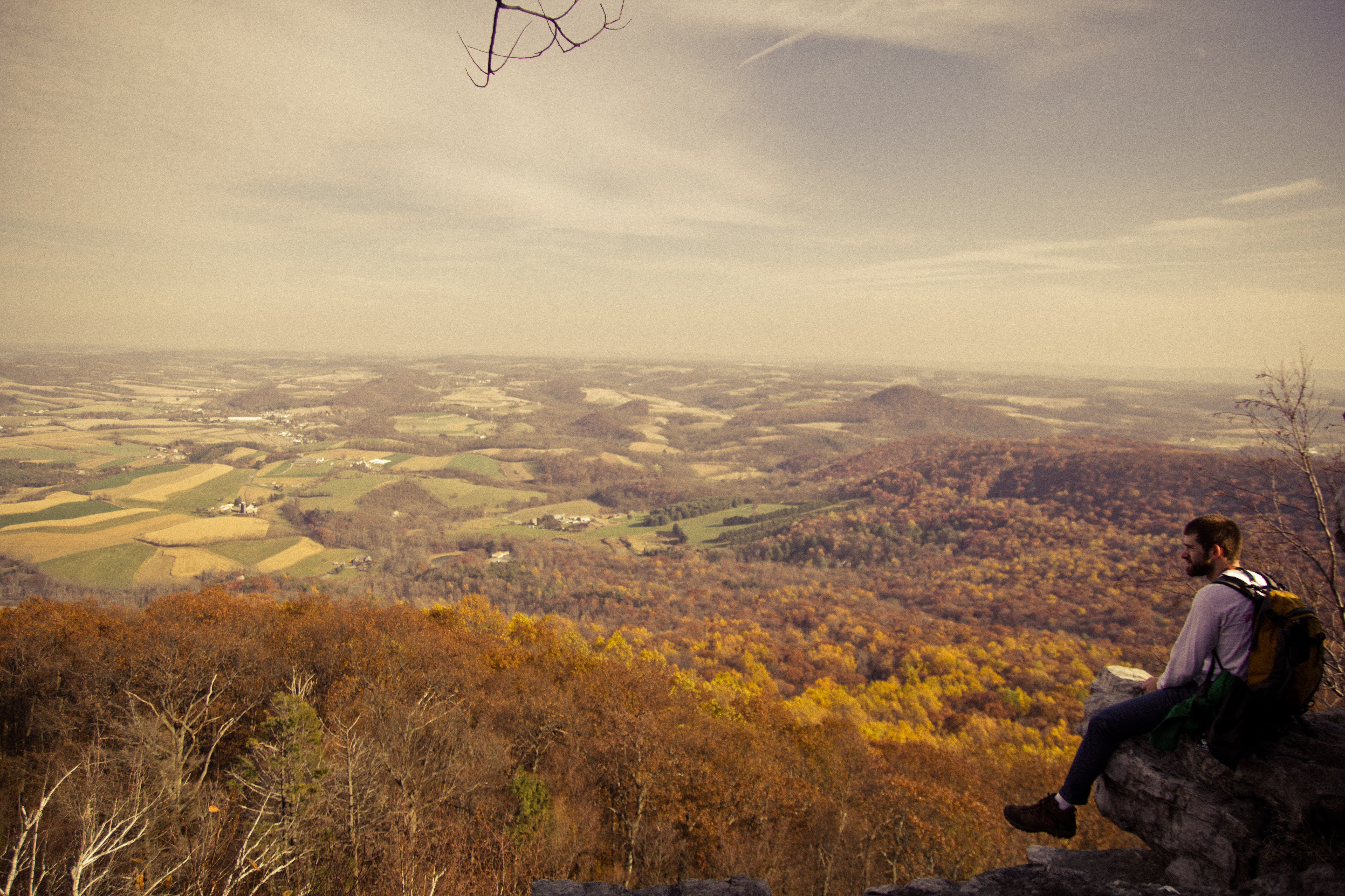
The Bald Eagle State Forest, named after the famous Native American, Chief Bald Eagle, is 193,424 acres and offers over 200 miles of hiking trails and an array of other outdoor activities.  The best known trail of Bald Eagle State Forest, The Mid State Trail, grants hikers a breathtaking vista of the Bald Eagle and Rothrock State Forest, across the Lauren Run reservoir, and into the valley beyond. Be sure to wear hiking boots on this difficult trail because parts of the trail consist of hopping from rock to rock.
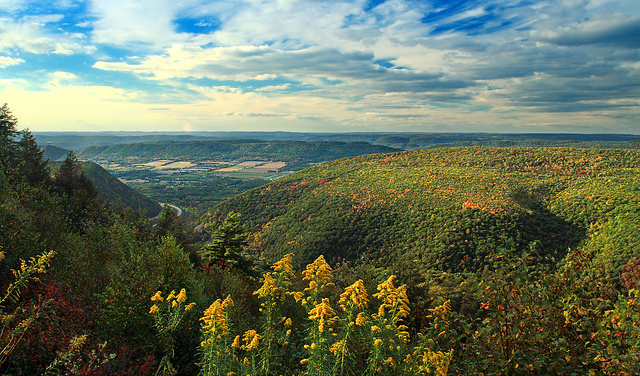
Click here for more information.
Trail difficulty rating: Moderate/Difficult
Location: Bald Eagle State Forest, T420, Bellefonte, PA 16823. 1 hour and ten minutes away.
3. Flat Rock Trail
Flat Rock Trail located in Colonel Denning State Park was highly recommended to me by a Bucknell alumn, as well as avid hiker, Doug Bogan. “The views from the overlook are amazing. You can see for maybe 30-50 miles on a clear day!” he says. The stunning vista of the verdant Cumberland Valley and beyond is one of the many rewards of the 5.1 mile hike.
Click here for a detailed guide for the hike.
Trail difficulty rating: Moderate
Also be sure to check out the other activities the State Park offers here.
Location: Colonel Denning State Park, Newville PA. Click here for detailed instructions. 1.5 hours away.
4. Canyon Vista Trail
The Canyon Vista Trail in Worlds End State Park is a 4 mile loop that challenges hikers with rocky, steep sections leading to a stunning view of the Loyalsock Creek Gorge. The Penn Department of Conservation and Natural Resources website suggests for hikers to “explore the blocky maze of the Rock Garden adjacent to the vista. A second rock labyrinth is found in the easternmost section of the trail where it runs parallel to Cold Run Road.” And, on the descent, if you are feeling aggressive, try trailblazing straight down to the river approximately 600-800 feet below instead of using the switchbacks.
Click here for more info of the Hiking Trails at Worlds End State Park. 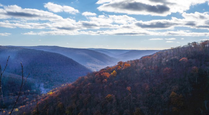
Trail difficulty rating: Moderate/difficult
Location: 82 Cabin Bridge Rd, Forksville, PA 18616. 1 hour and ten minutes.
5. West Rim Trail
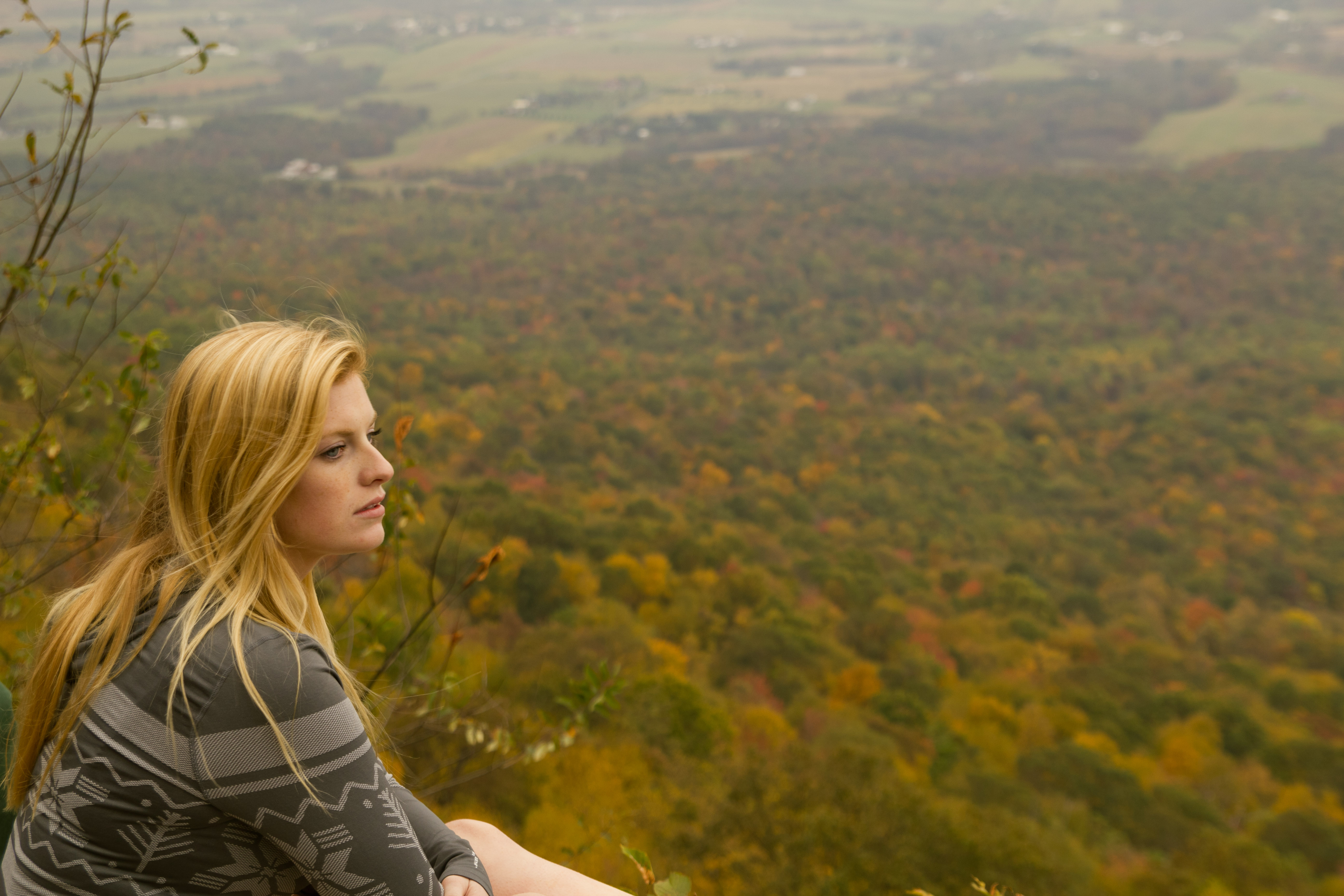
Deemed the “Best Hike in Pennsylvania” by Outside Magazine, the West Rim Trail treats hikers to several vistas that overlook  Tioga State Forest and beyond. The 30 mile West Rim Trail is just one of the many trails located in Pine Creek Gorge, commonly called the PA Grand Canyon. Don’t worry though – you do not have to commit to the full 30 miles. There are many trails that feed into the West Rim Trail so hikers can explore just a few miles. If you want to commit to the full 30 miles however, 2.5 days is recommended. October is the best time to hike due to the spectacular foliage.
Trail difficulty rating: Moderate
Click here for more information about the West Rim Trail and the other hikes and activities of Pine Creek Gorge.
Location: The trail’s northern terminus is on State Forest land approximately one mile south of U.S. Route 6 on the Colton Road near the village of Ansonia (1 hour and 45 minutes). The southern terminus is on Pennsylvania Route 414 two miles south of Blackwell (1.5 hours).
6. The Pinnacle overlook
Share your birds eye view of Lehigh Valley with the many hawks soaring at the peak of the Pinnacle Trail. According to Hike America, “Many Appalachian Trail thru-hikers claim the views at the Pinnacle are the best views on the Pennsylvania stretch of the Appalachian Trail.” 1 Another striking feature of the trail besides the wildlife and view is the huge boulder formation culmination at the top. Bogan says, “The boulder formation has a cavity through the entire thing, so you will usually find people climbing the inside of the formation.”
Trail difficulty rating: Easy/moderate
Click here to learn more about the trail.
Location: The Pinnacle Overlook, Holtwood, PA 17532. 2 hours and 20 minutes
7. HARTLEY ROPE SWING
If you are looking for a different outdoor activity other than hiking, swing off a 15 foot platform into a refreshing river running through a verdant forest of Evergreens. Or, jump off one of the three platforms, with the tallest measuring about 35 feet above the 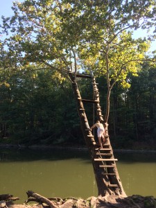 water. This simple trip to this rope swing was one of the best afternoons I have had at Bucknell.
Location: 524 Pardee Road, Hartley, PA 17845. The GPS will say you have arrived but you need to continue down the street a little more and veer right where there will be a fence and a little path. Park there, walk down the path about 400 feet and the rope swing will be on your left. 35 minute drive.
If you are looking for a quick getaway:
1. Buffalo Valley Rail Trail

The Buffalo Valley Rail Trail is a 9.2 mile path that stretches between
Lewisburg and Mifflinburg, PA. The flat and open trail right off campus provides views of pastures, fields, farmhouses, the occasional horse and buggy, and lots and lots of corn. Completed just two years ago, the path of asphalt and gravel is great for a bike ride or long run. It runs parallel to Route 45, so at about mile 4 you can traverse off the path to go to  Ard’s Farm.
To learn more about BVRT, click here.
Location: <1 mile away from campus. Go west on 45, turn right on 13th street to find parking and the start of the trail.
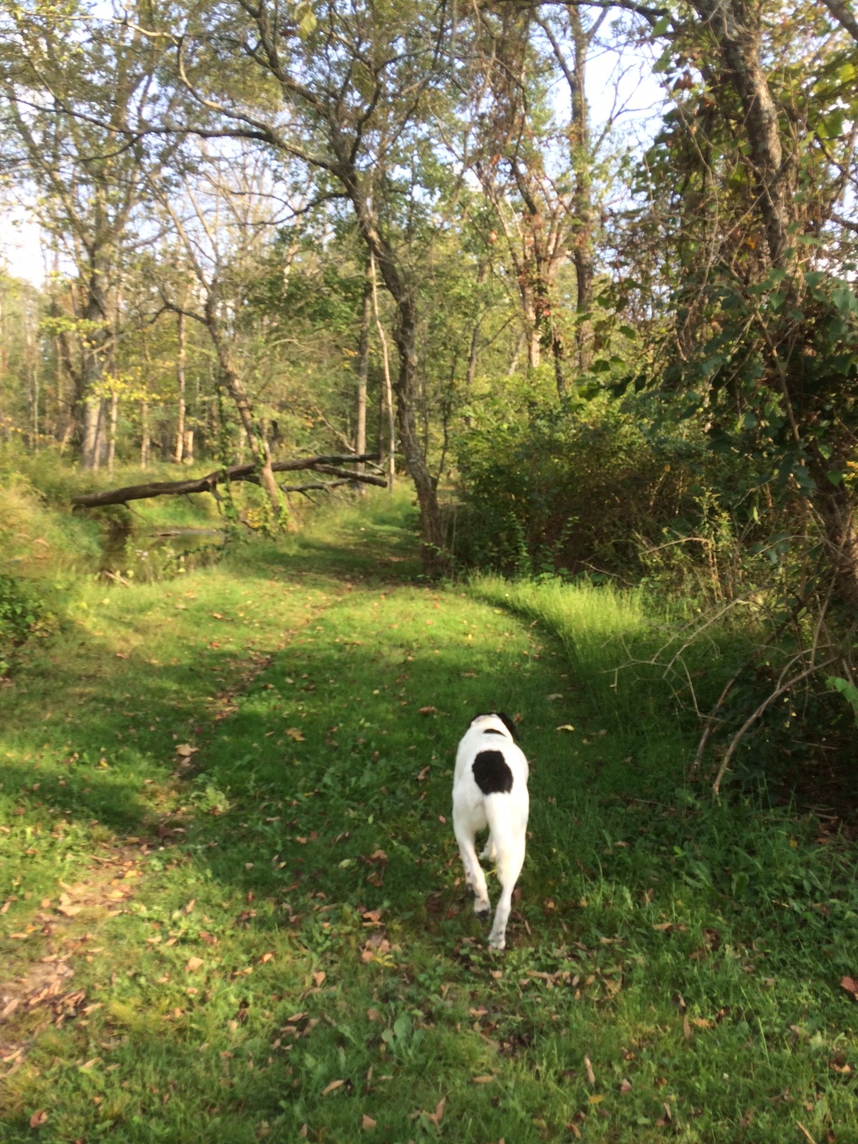
2. Turtle Creek Dog Park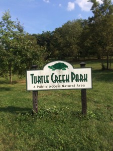
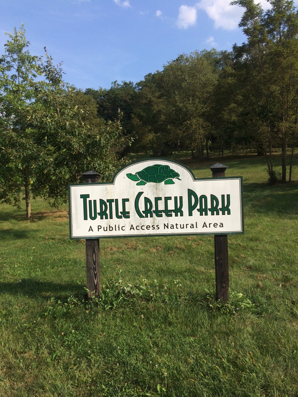
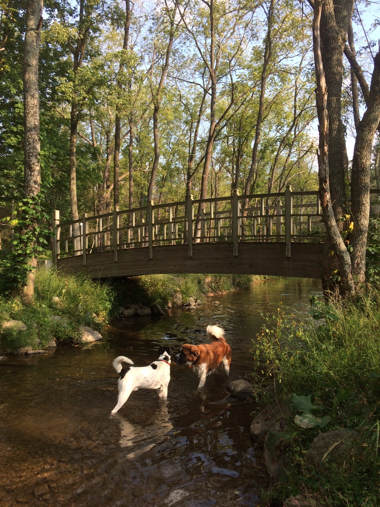
Explore Turtle Creek Dog Park, an entanglement of nature paths that lead to a serene little creek with a Monet-like bridge and picnic table. The fenced in area is a great place to bring your dog, if you are lucky enough to have one, play and run off-leash.
Location: Supplee Mill Rd and Furnace Rd, Lewisburg, PA. 5 minute drive from campus.
Sometimes, it may seem like a hassle to schedule one of these outdoor activities into our busy weekends, but the reward is far greater than one would think. Trying something different is when we make the best memories. To quote my favorite Romantic poet, William Blake, “Great things happen when men and mountains meet.”
- “Appalachian Trail: The Pinnacle.” Trails.com. Demand Media, n.d. Web. 21 Sept. 2015. ↩
Leave a Reply